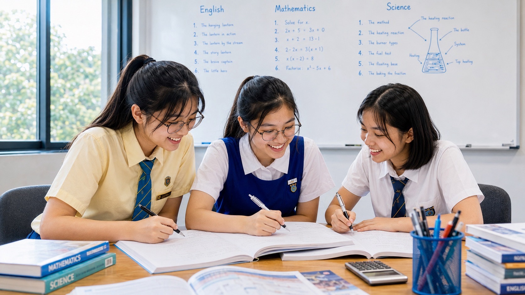
Parents preparing a child for Secondary 2 G2 Geography should focus on how cities provide housing, transport, services and a healthy environment while managing limited land and resources. The student must be able to read maps and data, describe spatial patterns, explain why city features are located where they are, and evaluate decisions that affect different groups of people. The most useful preparation is to review Secondary 1 map and resource-management skills, identify the child’s recurring difficulties and practise one evidence-based explanation at a time. Geography is not a contest to memorise place names or write the longest essay.
MOE’s Lower Secondary G2 and G3 Geography syllabus is organised around sustainable resource use and management. Its second thematic question, ‘How Can We Sustainably Build Cities?’, focuses on Housing and Transport Systems. Students also practise Geographical Investigation through school-guided inquiry. The earlier natural-resource topics on Water and Tropical Rainforests and Mangroves remain useful foundations, but the actual topic order and assessments follow the school. This is a lower-secondary school subject, not a national SEC paper in Secondary 2. A student in Secondary 2 in 2027 would ordinarily reach Secondary 4 in 2029, with later Humanities combinations and subject levels to be confirmed through the school.
Quick information for parents
• Subject: Secondary 2 Geography at G2 under Full Subject-Based Banding; verify the school’s current programme.
• Main second-year theme: sustainable cities, with Housing and Transport Systems as the two prescribed urban topics.
• Previous foundation: map skills, Water, Tropical Rainforests and Mangroves, geographical thinking and inquiry.
• Skills: describe urban patterns, explain causes and effects, compare stakeholders, read graphs, evaluate management measures and communicate evidence.
• Geographical Investigation: students work through inquiry stages and one selected GI each year under school guidance.
• Home routine: one map or graph, one geographical explanation, one comparison or judgement and a correction review each week.
• Parent checks: fieldwork safety, neighbourhood data, current assessment formats, school consultation and Secondary 3 Humanities choices.
• Success indicator: a child who can identify the geographical problem, explain a process and justify a realistic response without copying a memorised answer.
What G2 Geography means in Secondary 2
G2 describes the individual subject level, broadly aligned with the previous Normal (Academic) standard. Full Subject-Based Banding does not treat this as the student’s permanent stream. A child may take different subjects at different G levels under the relevant policies and school arrangements. For preparation, use the actual G2 Geography textbook, teacher instructions and current syllabus rather than assume that every G3 extension topic is compulsory.
Secondary 2 can be the first time a child sees the estate where they live as a geographical system. Housing blocks, bus routes, shops, playgrounds, parks, schools and drainage interact. The question is not simply whether a feature exists. Geography asks why it is located there, who uses it, what effects it has and how the town could be managed for different needs.
The city focus also introduces trade-offs. More housing may help meet demand while requiring land, infrastructure and services. A transport improvement may benefit many travellers while causing noise or construction effects for some residents. Students should be able to analyse those differences fairly and avoid writing that one measure is automatically best for everyone.
How the two-year MOE curriculum fits together
| Two-year theme | Topic | Learning contribution |
|---|---|---|
| Natural resources | Water | Resources, supply, demand, pollution and sustainable management |
| Natural resources | Tropical Rainforests and Mangroves | Vegetation, adaptations, environmental functions and conservation |
| Sustainable cities | Housing | Urban patterns, facilities, needs, impacts and management |
| Sustainable cities | Transport Systems | Movement, mobility options, access, impacts and sustainable planning |
| Across both themes | Geographical Investigation | Framing questions, collecting data, analysing, concluding and reflection |
The first thematic question helps students understand natural resources and the trade-offs of using them. The second applies geographical reasoning to urban systems and everyday life. A city cannot supply housing or transport without using land, materials and energy, so earlier sustainability ideas remain relevant. Parents can use this connection to help children retrieve earlier learning.
The school may vary how teaching is organised across the two years. The curriculum indicates a direction of inquiry and content scope, not a guarantee that each class is assessed on the same day or with the same weighting. Ask about the current school sequence and select home practice accordingly.
Begin with a small urban Geography diagnostic
Select three pieces of recent work: a map or photograph, a graph and a structured explanation. Give the student a new example and ask them to work independently. Do they understand a legend? Can they describe a spatial pattern? Can they identify a cause without inventing it? When comparing two transport options, do they use the same criteria and data for both?
- Location: does the student recognise where a feature is situated and how it relates to others?
- Graph: are scales, units and quantities read accurately?
- Explanation: does the response connect a process with the observed outcome?
- Comparison: are both alternatives considered on a common basis?
- Judgement: does the conclusion weigh relevant benefits and constraints?
- Investigation: can the pupil identify what evidence would answer a question?
- Independence: can a similar but different case be solved without a model answer?
A wrong final answer may have a simple cause. If the child says one housing estate has greater density because its bars look taller, they may have ignored the graph’s axes or denominator. If the student knows the facts but cannot write a balanced evaluation, the issue is communication and reasoning. Repair the specific problem rather than assign every Geography chapter again.
Four geographical concepts: space, place, environment and scale
Space asks how things are arranged; place asks what makes a location distinctive; environment includes physical and built relationships; scale distinguishes a neighbourhood, city and larger region. These concepts help students organise urban geographical questions.
Ask the child to describe a town centre from a map. Next ask what makes it valuable as a place for residents and visitors. Then consider how the same location fits within the transport and service system of an entire city.
Teach the pupil to identify which scale the question asks about. A facility that works for one neighbourhood may have different effects when considered in a national land-use plan. One map cannot answer every question about all three scales.
Urbanisation and why cities grow
Urbanisation involves an increasing share of people living in urban areas and the development of urban systems. Cities attract and support varied activities, but growth increases demand for land, housing, services and mobility. Population size alone does not determine living standards.
Use a hypothetical comparison between two towns with different population densities. Ask what additional information is needed to assess quality of life: housing conditions, access to facilities, environmental quality and transport may all matter.
Avoid the slogan that bigger cities are always worse or better. A valid answer identifies the geographical process and which outcomes the evidence supports.
The meaning of sustainable cities
A sustainable city seeks to meet residents’ needs while considering environmental, social and economic consequences over time. Housing and transport are especially important because they shape where people live, how they move and what resources are required.
A new housing development may offer more homes but also create demand for schools, public transport and green space. Students should trace these connections rather than assume a development is complete once buildings have been constructed.
A balanced evaluation identifies who benefits, what resources are used, any impacts on nearby areas and what could make the proposal more sustainable.
Housing as shelter and community
Housing fulfils a basic human need for shelter, but urban housing also connects to safety, health, services, community life and access to opportunities. A student should distinguish the physical building from the wider neighbourhood in which people live.
Ask which facilities would help residents of a new estate: transport, schools, shops, parks and healthcare access may be relevant. A photograph of new housing cannot establish whether all these facilities are adequate without further information.
The best answer explains why a facility serves a particular need and what evidence would show whether residents use or value it.
Urban housing patterns
Housing can differ in density, building type, age and spatial distribution. A map or photograph may show concentrations of high-rise blocks, low-rise residences or mixed development. Describing what is present is different from explaining why it developed.
Use a map of an imaginary urban area. Ask which zones are more densely developed and whether they are near transport corridors or other features. The observed association might support an explanation, but causation needs more information.
The learner should identify the relevant scale and give clear location references. A generic sentence that ‘houses are everywhere’ does not demonstrate spatial interpretation.
High-density and high-rise housing
Where land is limited and urban demand is high, high-rise housing can enable more people to live within a given land area. This involves trade-offs involving shared facilities, access, construction costs, services and environmental management.
Ask the student to compare two developments using available land area, dwelling numbers and access to facilities. A taller building is not automatically proof of higher quality of life or better transport access.
A reasoned response identifies the benefit and a relevant constraint. It should avoid assuming that a single housing type suits every household in every location.
Public housing and the Singapore context
Singapore’s housing system offers useful context for studying urban geography, including how residential developments relate to town planning, infrastructure and public services. Students should use school-approved and official sources for actual policy details and avoid invented property statistics.
A student can examine how a neighbourhood’s housing blocks relate to bus stops, schools, markets and green spaces on a map. Then ask whether distance alone establishes actual access, since walking conditions and mobility needs also matter.
Do not turn a Geography task into financial advice about buying a flat. The educational objective is to understand land use and residents’ needs, not predict house prices or recommend a property purchase.
Neighbourhood facilities and amenities
Markets, playgrounds, clinics, shops, sports spaces and parks have different roles in supporting daily life. Geography considers their locations, accessibility, usage and effects on the surrounding environment.
Ask which facilities a child, working adult or older resident might use differently. A playground can be valuable for some families, while a sheltered walkway may be especially helpful for people with mobility needs.
The student’s evaluation should recognise varied users rather than claim that every amenity is equally important to everyone. Stakeholder needs shape a geographical judgement.
Urban environmental conditions
Dense development can affect heat, noise, air quality, drainage and green-space availability. The mechanisms are often connected to land cover, traffic, building arrangement and environmental management.
A photo showing a paved open space and another showing shaded vegetation can support a comparison of visible features. To conclude that one site is consistently cooler requires temperature measurements under comparable conditions.
Teach the child to separate an observed feature from a measured environmental effect. A plausible explanation is not proof without suitable data.
Housing-management strategies
Urban planning can seek to improve the supply and quality of housing, access to amenities, environmental conditions and community participation. Strategies vary among cities and depend on resources and local circumstances.
A proposed shared garden might provide social and environmental benefits but require maintenance and take up space. The pupil should explain these relationships instead of praising the proposal simply because it contains greenery.
A good evaluation identifies intended beneficiaries and a realistic limitation. If data are given, use them rather than replacing the question with a generic essay.
Transport as a movement system
Transport systems move people, goods and services and connect different places. Their components include routes, vehicles, interchange points, infrastructure and management. A student needs to understand both physical networks and the people who use them.
Ask how a bus stop, MRT station, road and footpath together serve a neighbourhood. A transport map can show available links, but actual travel time or service reliability needs additional information.
The child should describe the system before judging it. A route that looks short on a map may require transfers or include barriers not visible at the chosen scale.
Public and private transport
Transport options can include walking, cycling, buses, rail and private vehicles, each with different capacity, convenience, costs and environmental effects under particular conditions. Geography does not require declaring one mode universally superior.
A comparison could consider two ways to reach school, using facts supplied about fares, distance, accessibility or travel time. A responsible answer states the criterion and uses the same basis for each mode.
Do not invent real journey metrics or claim a particular service is always available. Use official transport information for current practical claims and school-provided data for examination exercises.
Transport accessibility and different users
Accessibility concerns how easily people can reach destinations and services. Distance is relevant but not sufficient; footpath conditions, step-free access, waiting times, transfers and the needs of different users can change practical accessibility.
Compare the journeys of a pupil carrying a schoolbag, an older resident and a wheelchair user in a fictional transport scenario. Ask which features matter for each and what a fair transport system could provide.
Avoid treating one able-bodied travel pattern as representative of everyone. A good answer recognises mobility differences and identifies a specific infrastructure or service response.
Transport demand and congestion
Urban transport systems face changes in demand across places and times. Congestion can arise when demand exceeds capacity in a particular part of the network, with impacts on travel, emissions or residents’ experiences.
A table showing vehicle numbers or travel times during different periods can help students identify a peak. But a change in total journeys does not automatically reveal the cause of a delay without information about network conditions.
A strong answer states the measured pattern and explains a relevant mechanism. The student should avoid a universal claim that building more roads always removes congestion.
Environment and transport
Transport can influence air quality, noise, energy use and land demands. The significance of these effects depends on vehicle types, operating patterns, infrastructure and other conditions.
Ask the child to identify which part of a transport proposal might reduce environmental impacts and which may create new costs. For example, better access to public transport can change travel choices, but the outcome should be examined rather than assumed.
A sustainability evaluation considers environmental effects alongside access, affordability and practicality. The strongest explanation is specific to the given proposal.
Integrated land-use and transport planning
Planning housing, jobs and services together with transport can affect the ease and cost of travelling. Multi-purpose interchanges, connected walking routes and other measures can make different urban activities more accessible.
Give a fictional town map with homes far from services and ask where a transport interchange might help. The choice should be justified by residential concentration, possible destinations and available space.
A student should consider who would be served and what trade-offs arise. A central location is not automatically best if the map or constraints show a different need.
Transport policy and road safety
Transport management includes legal, infrastructural and behavioural measures. The MOE syllabus uses road safety and wider transport planning as examples. Students should identify how a measure addresses a specific hazard or mobility issue.
A safe school-zone proposal might involve crossing infrastructure or clearer traffic management. The pupil should explain which danger or difficulty the measure seeks to reduce and how effectiveness might be evaluated.
Do not invent local accident counts or present unsafe road observations as a home experiment. A school fieldwork task should use approved safe sites and supervision.
Research and technology in transport
Navigation applications, mobility data and transport technologies can improve information and help users plan journeys, but the results depend on data quality, accessibility and service conditions.
A map application may show a possible route. It does not guarantee that the actual waiting time will be identical every day. Ask the student which information is predicted, which is confirmed and how updates affect decisions.
Geographical reasoning includes recognising technology’s limitations and the needs of people who cannot use a particular digital service easily.
Comparing cities and neighbourhoods
Singapore and other cities may have different population densities, land availability, transport networks, housing policies and physical conditions. Geography asks the pupil to compare relevant factors without assuming that one policy can be transplanted unchanged.
Use two invented city profiles: one compact and rail-connected, another more spread out. Ask how route planning or housing needs may differ. The child should work from the supplied evidence rather than rely on stereotypes.
A good comparison addresses the same criteria in both locations and explains why different contexts may require different responses.
Geographical Investigation in a neighbourhood
MOE’s Housing Geographical Investigation explores how facilities in a neighbourhood are used and what effects they have on people and the environment. It follows inquiry stages such as framing a question, collecting data, analysing results and drawing conclusions.
A school-approved task could examine whether students find a particular public space accessible. Data might include observations, mapped facilities or voluntary responses gathered with permission. A single survey does not prove how every resident feels.
Students should report sampling limits and any differences among users. Parents can help organise materials while leaving the child’s questions, observations and conclusions to the learner.
Investigating transport mobility
The Transport Systems Geographical Investigation considers mobility options, people’s differing needs and the effects of transport choices. It provides opportunities to use mapping, counts and other appropriate observations under school guidance.
An investigation might compare the accessibility of two routes using safe, supervised methods and defined criteria. The learner should record what was measured and distinguish actual observations from assumptions about the whole transport network.
Do not send a pupil alone into unsafe traffic environments or require interaction with strangers without consent. School safety and privacy rules take priority.
Primary, secondary and qualitative data
A geographical investigation may combine direct observations, public datasets, photographs, maps and voluntary survey information. Each source type has strengths and limits. Numbers can show a trend, while interviews may reveal attitudes or reasons that cannot be inferred from counts alone.
A two-hour observation count describes that period and site, not every day of the year. A survey of willing respondents may not be representative of all residents. A city-wide statistic may be too broad to describe one estate accurately.
Teach the learner to state data source, time, unit and sample size where relevant. Accurate context prevents an otherwise neat graph from supporting a misleading conclusion.
Graphs, maps and spatial relationships
Housing and transport data can appear as thematic maps, bar charts, tables, route diagrams, photographs and text. Students must identify legends, axes, scales and the population or area being compared.
A chart of total journeys may differ from a chart of trips per resident. Comparing only the totals may lead to an incorrect conclusion if population sizes differ. Ask which denominator the question needs.
The child should describe the pattern first and then consider a geographical explanation. A correlation between nearby facilities and visits does not automatically prove why a person chose a route.
Writing supported sustainability judgements
An evaluation question asks the pupil to weigh an intervention against relevant criteria. A solution may improve environmental conditions while costing more or serving some users better than others. The answer should use the specific challenge and supplied evidence.
For a proposed sheltered walkway, discuss access in hot or wet conditions, maintenance, land constraints and which residents benefit. A generic claim that walkways are good does not demonstrate a full evaluation.
A useful paragraph frame is proposal, mechanism, benefit, limitation and judgement. The pupil should adapt this to the actual task rather than reproduce the same conclusion for every urban issue.
An eight- to twelve-week G2 Geography learning plan
| Period | Main focus | Evidence of progress |
|---|---|---|
| Weeks 1–2 | Review previous maps and resource-management concepts | Accurate maps, units and descriptions |
| Weeks 3–4 | Learn housing patterns and residents’ needs | Clear explanation of location and function |
| Weeks 5–6 | Investigate amenities, urban environment and planning strategies | Relevant benefits and limitations |
| Weeks 7–8 | Read transport systems and mobility data | Fair comparisons of modes and access |
| Weeks 9–10 | Practise school Geographical Investigation methods | Useful data, ethical sampling and source records |
| Weeks 11–12 | Interleave urban case questions and evaluate strategies | Independent, evidence-based conclusions |
This is a family example, not the school’s official term timetable. The sequence should follow actual teaching and fieldwork. A student who cannot interpret a graph should receive focused data help before being forced to write a long urban-planning evaluation. Another who already reads maps well may benefit from more stakeholder comparisons and reasoning.
A manageable week might combine a map or photograph exercise, a short housing or transport explanation, and one evaluation paragraph, followed by a correction. Revisit an earlier task with changed data after several days to see whether the skill transfers.
How to improve Geography writing quickly
Start by reading the command word. ‘Describe’ asks what a pattern shows; ‘explain’ asks why; ‘compare’ needs both cases; ‘evaluate’ requires a supported judgement with relevant limitations. A student who writes a long description in response to an explanation question may know the facts but still fail to address the task.
A useful answer can begin with one clear idea followed by the geographical process and an example. For instance, a sheltered route may improve pedestrian access because it provides more comfortable movement in rain and sunshine. If the question asks for limitations, explain cost, maintenance or the site-specific constraints when those are relevant.
Do not make every paragraph the same length. Some tasks require one fact, while others demand a reasoned comparison. A G2 learner benefits from concise, accurate language and a clear connection to the evidence rather than ornate vocabulary that obscures the argument.
What parents should ask the Geography teacher
- Is the subject correctly recorded as G2 Geography, and what is the actual Secondary 2 topic order?
- Which Housing and Transport Systems concepts will be assessed in this term?
- How are spatial descriptions and geographical explanations marked?
- What fieldwork or GI project is planned, and what supervision or privacy rules apply?
- Which map, graph and written communication skills cause the greatest current difficulties?
- What resources or consultations are recommended for a student who needs help?
- When are upper-secondary Geography or Humanities combinations explained?
- What subject-level review procedures apply under school policy, if relevant?
Common mistakes parents can help avoid
Studying only Water and Rainforests. Those are part of the first thematic question, while Secondary 2 includes sustainable-city learning about Housing and Transport Systems. Check the actual school sequence.
Assuming the first available map provides all the evidence. A map can show spatial distribution while failing to reveal usage, opinions or service reliability. Ask which data are missing.
Calling one transport mode universally best. Different modes serve different users and contexts. Compare accessibility, cost, environmental effects and constraints using the provided information.
Ignoring Geographical Investigation. Inquiry, sampling and evaluation are part of lower-secondary Geography. A school-guided task develops research and communication skills beyond simple textbook recall.
Using an upper-secondary SEC Geography book as a Secondary 2 paper. These are separate learning stages and examination cohorts. Use current MOE lower-secondary content and school guidance.
Frequently asked questions
Is Secondary 2 G2 Geography an SEC examination? No. The subject is assessed by the school. SEC applies to graduating upper-secondary candidates, based on later subject offers and the correct examination year.
What are the main Secondary 2 themes? The second thematic question in the MOE two-year syllabus concerns building sustainable cities, with Housing and Transport Systems. The school determines precise timing and assessment.
Is Geographical Investigation required? MOE’s lower-secondary syllabus describes one selected GI per year. The school guides its actual methods, locations, assessment and safety.
Does the student need to visit other cities? No. Maps, school materials, official datasets and approved local fieldwork can teach the relevant concepts without expensive travel.
Can the child use examples from Singapore? Yes, where relevant to the syllabus and question. Avoid inserting unverified statistics or assuming one local case explains every city.
Will G2 Geography guarantee an upper-secondary Geography subject? No. Offerings, subject combinations and eligibility are school-specific.
Is extra tuition automatically needed? No. A focused school and home practice routine may be sufficient. Consider additional help for persistent, identified difficulties.
A first-term parent checklist
- Confirm the current G2 Geography level and syllabus.
- Review map legends, scales, units and spatial descriptions.
- Link housing patterns with residents’ needs and urban facilities.
- Explain why green spaces, services and amenities matter.
- Compare housing proposals with specific benefits and limitations.
- Read transport networks, accessibility and mobility options accurately.
- Consider the needs of different age and mobility groups.
- Describe impacts on the urban environment without overclaiming.
- Understand geographical inquiry, sampling and source limitations.
- Respect fieldwork supervision, safety and privacy.
- Use new data to retest corrected skills.
- Ask about the school’s Secondary 3 Humanities choices.
- Keep a sustainable routine alongside other subjects and rest.
Official sources and related eduKate guides
The main official source is MOE’s Lower Secondary G2 and G3 Geography syllabus. For subject-level arrangements, consult MOE Secondary Education. The SEAB SEC overview explains the different graduating framework. Relevant companion articles include Secondary 1 G2 Geography and Secondary 3 G3 Geography, remembering that they have different levels and purposes.
A strong Secondary 2 G2 Geography student can read a map or graph accurately, explain how urban features influence people’s lives and evaluate a housing or transport strategy fairly. These abilities help with future Humanities learning and make the child a more thoughtful reader of everyday information about the places people share.
Explore related parent guides: Secondary 1–4 preparation and transition guides.