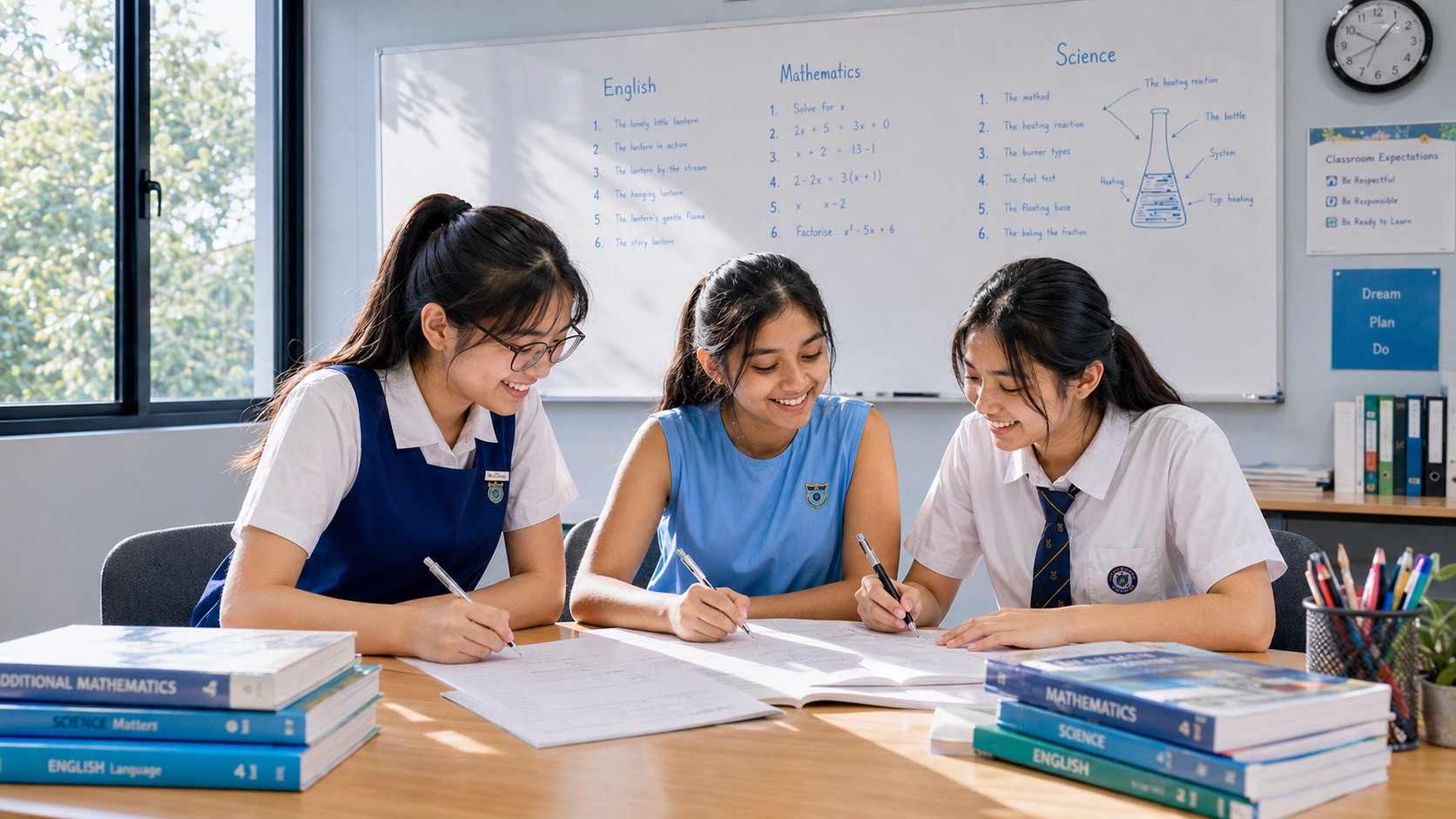
Parents preparing a student for Secondary 1 G2 Geography should begin with map reading, describing patterns, understanding how people use natural resources and explaining evidence from photographs, diagrams and data. Geography is not a subject in which students merely memorise capitals and mountain names. A new Secondary 1 learner needs to recognise how places, people and environments are connected, and to describe those relationships in clear sentences. The most effective preparation begins with the school’s actual lower-secondary topic list, a few short diagnostic tasks and a routine that develops reading, data and explanation skills without overwhelming the student after PSLE.
MOE’s official Lower Secondary G2 and G3 Geography syllabus is organised around the theme Sustainable Resource Use and Management. The first thematic question concerns Water and Tropical Rainforests and Mangroves, and the second examines Housing and Transport Systems in sustainable cities. The two-year syllabus also includes Geographical Investigation. Secondary 1 G2 Geography is school-based, not a 2027 SEC graduating paper. A pupil entering Secondary 1 in 2027 would ordinarily graduate in 2030; later upper-secondary subject options and examinations depend on the school’s actual offerings and the student’s choices.
Quick information for parents
• Subject: Secondary 1 G2 Geography within Full Subject-Based Banding.
• Primary themes: Water, Tropical Rainforests and Mangroves; Housing and Transport Systems later in the two-year programme according to school teaching order.
• Immediate skills: map legends, orientation, distributions, photographs, graphs, causes, effects and basic sustainability explanations.
• Geographical Investigation: ask a manageable question, collect appropriate evidence, interpret results and recognise limitations under school guidance.
• Suggested routine: one short map exercise, one evidence-based explanation, one vocabulary or data activity, and a corrections review each week.
• School decisions: verify subject level, textbooks, current topics, assessment requirements, fieldwork supervision and available support.
• What to avoid: using an upper-secondary Geography SEC paper as a Secondary 1 test or assuming every child at G2 needs identical extra tuition.
What G2 Geography means under Full Subject-Based Banding
G2 is the level of the Geography subject, not a permanent stream or description of the whole student. Posting Groups assist with secondary-school admission and initial subject-level arrangements, while the actual subjects offered can differ by level where applicable under MOE and school policies. G2 is broadly aligned historically with the earlier Normal (Academic) subject standard, but the old labels should not be used to judge a child’s interests, capacity or future.
The pupil may be strong in observations but uncertain about reading a map’s scale, or may have good ideas yet struggle with the vocabulary of sustainability. These are different gaps. Parents should ask the child to demonstrate an actual task before choosing more exercises. A precise description such as ‘can describe a photograph but cannot explain the process shown’ gives the family a useful action.
Geography at G2 develops relevant knowledge and increasingly independent thinking. A child should learn what information a map contains, how a data pattern can be described, why a natural process affects people and how to consider more than one solution to a resource-management challenge. The standard is meaningful; it should not be trivialised into simple fact copying.
The official two-year learning map
| MOE lower-secondary area | Core question | Useful first-year preparation |
|---|---|---|
| Introduction to Geography | How do geographers examine people, places and environments? | Read maps, locate features, understand patterns |
| Water | How can a natural resource be managed sustainably? | Hydrological cycle, stores, availability, use and pollution |
| Tropical Rainforests and Mangroves | How do these environments function and why manage them? | Location, structure, adaptation, value and impacts |
| Housing | How can urban housing be managed sustainably? | Learn the concepts when the school introduces this topic |
| Transport Systems | How can cities support accessible, sustainable movement? | Compare routes and data when taught |
| Geographical Investigation | How can evidence answer a question about a place? | Source choice, observation, graphs and reflection |
This is the syllabus across lower secondary, not the compulsory contents of the first weighted assessment. MOE’s framework sequences its two thematic questions across the years of study and identifies specific guiding questions within each topic. The school should explain which parts will be taught during each term. If the current class begins with the geography of water, studying an entire final-year urban transport examination book is unlikely to be the best use of time.
Parents should also recognise that G2 and G3 are named within a shared MOE syllabus but do not always have identical learning outcomes or assessment demands. Use the current G2 textbook and teacher’s feedback for the expected level of explanation and evaluation. A G3 model answer can illustrate reasoning, but it should not be presented as the compulsory standard for every G2 child.
Understanding place, space, environment and scale
A geographical place has characteristics shaped by physical features, human activities and meaning. Space concerns how activities and features are arranged, while environment concerns natural processes and interactions with people. Scale asks whether we are considering a single park, an estate, Singapore or a wider region.
Parents can use a map of a familiar neighbourhood to ask where housing, transport and green space are located. Do not demand a complex urban planning essay; ask what the pattern shows and which facts the map cannot reveal. A map may show a park’s location without proving how many people visit each day.
A useful correction is to identify whether the student is describing what exists or explaining why it exists. ‘The park is near homes’ is a location description; explaining the possible value of access requires a relationship and, ideally, evidence.
Map legends, directions and scale
A map is an organised representation, not a complete photograph of reality. Students must read the title, legend, scale, north arrow and symbols before using it. A blue area might show water in one map or a category of activity in another; the key determines its meaning.
Ask the child to locate a suitable reservoir, river, park or coastal feature on a public map. They can describe its direction relative to another feature or compare approximate distances according to the given scale. A larger symbol does not necessarily mean a physically larger place.
Practise one map a week, then change the map style. If the student can follow only the identical textbook map, the skill has not transferred. The objective is to use unfamiliar legends and orientation confidently.
Describing a geographical distribution
A distribution describes where something is found and whether there is a pattern. It may be clustered, scattered, concentrated along a coastline or associated with particular climatic regions. A description needs accurate place references or observations, not a premature theory about causes.
Give the pupil a schematic map of tropical vegetation. Ask where mangroves and tropical rainforests appear before discussing climate or coastal conditions. They should not claim that every tropical coastline has mangroves simply because the broad distribution follows tropical regions.
The skill becomes more reliable when the student writes two separate sentences: one describing the observed distribution and one explaining a relevant condition. The second needs knowledge or evidence beyond the first.
Latitude, longitude and geographic location
Latitude and longitude provide a consistent geographic reference system. Latitude relates to the position north or south of the equator, while longitude indicates east–west position relative to a reference meridian. Tropical environments can be described with reference to broad latitude ranges, but latitude alone does not establish every local condition.
Ask the pupil to identify the equator and the broad tropical belt on an appropriate map, then locate Singapore approximately within that regional setting. Avoid turning the task into a large list of national coordinates. Understanding what a coordinate communicates is the foundation.
When using a climate map, ask what the data actually show. A location can be tropical yet experience different local conditions from another tropical place. A careful answer separates a broad classification from site-specific facts.
Water stores and the hydrological cycle
The MOE Water topic includes oceans, glaciers, rivers, lakes, groundwater and soil water, alongside processes of the hydrological cycle. Evaporation, transpiration, condensation, precipitation, infiltration, percolation, surface runoff and groundwater movement form connected pathways rather than a single circular arrow with no details.
A child can describe rainfall reaching a catchment: some may flow over the surface, some infiltrates soil and some enters storage or groundwater pathways. The precise route depends on land cover, slope, weather and ground conditions. A diagram should show what each arrow represents.
Give a partially labelled hydrological-cycle diagram and ask the learner to narrate the movement of water. If the child confuses infiltration with precipitation, teach the direction and location before asking for a full paragraph.
Water budget: surplus, deficit and storage
A water budget compares inputs, outputs and changes in storage within a catchment or system. A surplus arises when inputs exceed outputs in the relevant accounting, while a deficit has the reverse relationship. The terms must be used with reference to the defined quantities and period.
Use a simple imaginary example with 120 units of input and 100 units of output, leaving a positive net change of 20 units in storage, assuming the model includes all relevant flows. Ask what happens when output increases, and whether the calculation alone describes quality or access. It does not.
A student should first identify the given system and time. This prevents mixing yearly totals with monthly figures or treating rainfall as the same thing as usable water supply.
Floods and droughts
Too much rainfall within a period or setting can lead to flooding, while prolonged lack of rainfall may produce drought. The actual consequences depend on geography, land use, infrastructure and other conditions. The syllabus connects water availability to environmental and human processes.
Ask the learner to compare two fictional charts: one shows a short intense rainfall event and the other prolonged low precipitation. Which risk may be more relevant in each? Explain without claiming that rain alone accounts for all flooding or drought impacts.
A good response states the physical change, identifies its relationship to water storage or flows, and then explains the consequence in the provided setting. Avoid universal statements such as ‘rain always causes a disaster’.
People’s uses of water
Water is used in domestic activities, agriculture, industry, recreation and natural ecosystems. These uses can create competing demands, especially where supplies are limited or water quality is threatened. The syllabus asks students to connect the physical resource to the people and environments that rely on it.
Use a small table of hypothetical water users to identify the purpose of each use. Ask whether a change in supply could affect all users equally. It may not: different activities require different quantities or quality standards.
The learner should not assume that all consumption can be eliminated or that conservation has no trade-offs. Geography asks how needs can be met sustainably and what evidence supports a particular approach.
Water pollution and water quality
Pollution can reduce the usefulness of water stores and threaten aquatic ecosystems. Sources and consequences vary with the setting. An examination question might show land use upstream and water measurements downstream, inviting the pupil to consider possible relationships.
Teach the child to distinguish a measured result, such as an increase in a pollutant indicator, from a conclusion about a precise source. A pollution source may be plausible without being proven by one reading. The direction of flow and other activities may matter.
Students should read the graph axes, location and dates before drawing a conclusion. A changed unit or sampling point can change what a numerical comparison means.
Managing water sustainably
The MOE syllabus includes approaches to improving quality, reducing consumption, enhancing water technology and international water supply arrangements. These respond to different aspects of water management. A strategy improving supply should not be confused with one reducing demand or contamination.
Ask the pupil to choose a strategy for an invented challenge, explain how it works and identify a possible limitation. Water conservation may reduce use, while treatment infrastructure can improve the availability of usable water. Both can contribute but do not have identical mechanisms.
The best answer includes a supported judgement: which strategy addresses the stated problem most directly and under what conditions might it succeed? A generic ‘all solutions are good’ is not a full evaluation.
Singapore as a water-management context
Singapore offers a local case for discussing water catchments, treatment, reuse, desalination and conservation. These approaches form part of a wider water-security context. Parents should use the school’s current sources and official public information for factual details rather than copy unverified statistics.
Ask which part of a water problem a particular approach addresses: supply reliability, water quality, demand or resilience to change. Then ask what resource or infrastructure the approach may require. The point is to see interdependence, not to memorise a slogan.
The child can connect this learning to reservoirs and public information they encounter in Singapore. However, do not treat a single visit or photograph as a substitute for evidence about the whole national water system.
Rainforest location and layers
Tropical rainforests occur under suitable tropical climatic conditions and exhibit a layered vegetation structure often including emergent trees, canopy and undergrowth. Conditions vary across layers. The pupil should distinguish the visible structural pattern from the underlying climatic and ecological processes.
Show a labelled cross-section and ask why light may be different at the forest floor compared with the upper canopy. The child should use the structure of the vegetation to explain the difference, without assuming that every rainforest has identical species or features.
A new diagram with a different orientation tests the same understanding. If the child can only reproduce the original picture from memory, ask them to explain the function of each layer before moving on.
Rainforest leaf and root features
Adaptations such as broad leaves, drip tips and buttress roots can be discussed within the syllabus as examples of features associated with tropical rainforest conditions. A useful response connects a specific feature to its function under the relevant environment.
Instead of writing ‘rainforest leaves have drip tips’, ask why the feature may be useful and what it changes during wet conditions. A single photograph may show a feature without proving its biological benefit; the explanation comes from the relevant geographical knowledge.
Parents can build a simple table of environmental condition, adaptation and functional consequence. Change the example later and ask the student to identify the same relationship.
Mangrove location and adaptation
Mangroves are associated with suitable sheltered tropical coasts and estuaries, including waterlogged and saline environments. Some species develop specialised root structures or salt-related adaptations. Students should be able to compare these with rainforest adaptations without assuming they are identical.
Use a labelled photograph showing prop roots or other school-taught root forms. Ask what is observable, which condition makes the feature useful and why a different rainforest tree may show another adaptation. The relationship between location and structure is the key idea.
Avoid saying that mangroves grow on every shore or that a particular root feature appears in every mangrove species. More accurate statements recognise appropriate physical conditions and variation.
Environmental functions of vegetation
Rainforests and mangroves can provide habitats for biodiversity, store carbon, support nutrient or energy relationships and influence erosion under relevant conditions. These are different environmental functions, and each needs a process-based explanation.
If the question asks how vegetation can help protect soil, explain the relevant interaction of roots, rainfall and ground cover where appropriate rather than only state that forests are important. For coastal erosion, discuss the mangrove environment specifically.
A pupil should learn not to overstate. The presence of mangroves can contribute to protection, but effectiveness depends on conditions and scale. Evidence-based Geography is stronger than a blanket guarantee.
Human uses and resource extraction
People use tropical environments for resources, recreation, settlements and other activities. These can bring economic and social benefits while affecting habitats and environmental systems. Geography asks students to recognise both sides of a management issue, not assume that every human activity is automatically destructive or harmless.
A case involving forestry might include employment or raw materials alongside habitat loss and erosion risks. The student should identify whose needs are being discussed, the time scale and what evidence exists for the consequences.
Practise a comparison of short-term benefit and long-term impact. A supported judgement should explain which considerations matter most in the specific case, without inventing quantitative results.
Deforestation and the enhanced greenhouse effect
The syllabus includes resource extraction, deforestation and its links to environmental change. Removing vegetation can reduce habitat, influence carbon storage and make soil more exposed to erosion. The outcomes depend on land use, location and the scale of clearing.
Ask the learner to describe what is removed, which function is affected and what change might follow. A statement that deforestation ‘makes the Earth hot immediately’ is vague and overlooks mechanisms. A more useful explanation connects vegetation removal with a named process.
Use school diagrams and current sources for factual claims. Distinguish an established mechanism from a precise numerical effect that has not been measured in the case.
Management strategies and limitations
Protected areas, regulation, rehabilitation and public education can contribute to sustainable management, but each works through a different mechanism. The child needs to identify the proposed action, intended benefit and possible limitation.
An area designated for conservation may still require monitoring and enforcement. Restoration may depend on suitable species and local conditions. Education can raise awareness, but actual behaviour should be evaluated rather than assumed to change automatically.
At G2, a clear two-sided explanation is a useful milestone: why the approach helps and one plausible constraint. As the student progresses, encourage a judgement supported by the circumstances of the question.
Geographical Investigation: asking a useful question
Geographical Investigation follows an inquiry from a clear question through appropriate data collection, analysis, conclusions and reflection. It is not merely a field trip or a photographic assignment. A good question should be narrow enough to investigate safely and with the resources available.
A school may investigate a water store’s quality or people’s use of a nearby area, following approved methods. A parent should ask what observation answers the question and what additional information might be required. A single site visit is not a year-long trend.
Fieldwork must follow teacher supervision, permissions, privacy and safety. Do not send pupils alone to waterways, remote beaches or mangrove areas. Public data and teacher-provided datasets can build skills safely at home.
Primary and secondary evidence
Primary data are collected firsthand for a particular investigation; secondary data have been collected or published by others. Both can be useful, but the student should consider purpose, date, measurement method and limitations.
A photograph of a water store records visible conditions at one time. An official chart may show a measured indicator across several dates. Neither automatically answers every question about that water store. The learner should say what each source can support.
Teach accuracy in source reference and conclusions. A pupil who cites a number should include the unit and year, where relevant, and avoid presenting guesses as established findings.
Writing explanations and evaluations
Geography questions use distinct command words. A description states distribution or characteristics; an explanation connects process and outcome; a comparison covers both cases; an evaluation weighs a strategy against criteria and limitations.
A weak response says ‘Mangroves protect nature’. A clearer response identifies a function, explains the mechanism under the given coastal setting and considers whether that is the most important issue in the question. The extra detail is not decoration; it makes the reasoning explicit.
A temporary frame—point, process, evidence and implication—can help. Remove it when the child can create their own clear paragraph. A concise complete explanation is more useful than a page of unrelated facts.
A twelve-week G2 Geography transition programme
| Weeks | Study objective | Evidence parents should check |
|---|---|---|
| 1–2 | Read maps, scales and source information | Accurate descriptions of new locations |
| 3–4 | Learn water stores, hydrological processes and water budget | Correct interpretation of arrows and quantities |
| 5–6 | Examine water use, pollution and management strategies | Supported causes and relevant responses |
| 7–8 | Compare rainforest and mangrove features and value | Clear structure–function explanations |
| 9–10 | Practise sustainability judgements and simple inquiry | A reasoned benefit and limitation |
| 11–12 | Interleave geographical data, diagrams and written answers | Fewer repeat mistakes and greater independence |
This sequence is a family example, not the school’s official term calendar. Adjust the chapters to the actual school plan. If a student still struggles to read a map’s key, do not skip ahead into long evaluation paragraphs. First make the data understandable, then ask what the data imply.
A practical week might have one short map task, one concept or reading exercise, and one written explanation with teacher-style feedback. Revisit an earlier error through an unfamiliar representation. A child who understands rather than copies should gradually need less prompting.
How parents can talk about a geographical problem
Ask what the question wants: a place, a pattern, an explanation or a judgement. Then ask what evidence the task supplies. If a learner claims a reservoir has poor water quality, what observation or data supports that? If none is supplied, teach the child to frame a question rather than invent a conclusion.
A family discussion about the neighbourhood can reinforce the subject. Why might a shady park feel different from an exposed paved area? How could a transport route influence access to a service? These are useful prompts, but they are not substitutes for measurements or official data. Distinguish personal impressions from verified patterns.
Parents do not have to know every adaptation or hydrological term. Consult the textbook together when uncertain. Helping the student check evidence and structure a response can be as valuable as recalling a definition.
School support and future Humanities options
- Confirm the child’s G2 Geography subject level and current teaching sequence.
- Ask which maps, fieldwork methods and data tasks are assessed in Term 1.
- Find out which vocabulary and writing skills are prerequisites.
- Ask about safe school fieldwork and required permissions.
- Request feedback on the child’s description, explanation and evaluation responses.
- Ask when subject-level reviews occur under the school’s current policies.
- Later, request information about available upper-secondary Geography or Humanities combinations.
- Consider the child’s interests and complete subject workload, not one Geography grade alone.
A national list of upper-secondary examination subjects is not proof that every school provides every option. When the time comes, refer to the school’s actual subject-combination briefing. Strong lower-secondary geographical reasoning can support future study, but no single G2 result guarantees a particular elective or pathway.
When additional Geography tutoring may be useful
Extra support can help when a pupil repeatedly misreads maps, cannot link an adaptation to its function or writes vague sustainability judgements despite feedback. Begin with actual marked schoolwork and identify the precise gap. A good tutor should demonstrate the relationship, let the child attempt a new question and revisit the idea later.
Small groups can support discussion of different possible solutions when every student participates and receives correction. One-to-one support may fit a concentrated language or data problem. Neither format automatically guarantees a future subject-level change or examination result.
Frequently asked parent questions
Is Secondary 1 G2 Geography a 2027 SEC paper? No. It is a lower-secondary school subject. SEC applies to graduating candidates taking their registered upper-secondary subjects.
What is the main lower-secondary syllabus theme? Sustainable Resource Use and Management, with natural-resource and sustainable-city thematic questions across the two years.
Will the student study Housing and Transport Systems immediately? Not necessarily. Those belong to the two-year syllabus. The school’s current teaching order determines when they appear.
Does Geography require fieldwork? Geographical Investigation is an integral learning approach. Actual fieldwork should be undertaken with school guidance, safety and permission, not through risky independent excursions.
How do G2 and G3 differ? They are separate subject levels under Full Subject-Based Banding, with shared themes in the MOE syllabus and potentially differentiated learning outcomes. Use school guidance for actual assessment expectations.
Is tuition compulsory? No. Many children can learn successfully through school teaching, meaningful short practice and targeted feedback. Seek additional help for an identified persistent gap.
First-term parent checklist
- Read the actual G2 Geography school timetable and syllabus sequence.
- Learn map legends, north orientation, scales and spatial distributions.
- Describe what evidence shows before explaining why.
- Understand water stores, the hydrological cycle and water management.
- Compare rainforests and mangroves using accurate environmental conditions.
- Connect adaptations with function instead of memorising names alone.
- Consider the benefits and limits of sustainability measures.
- Use primary and secondary data responsibly.
- Follow fieldwork safety and privacy arrangements.
- Keep a small correction log and retest new examples.
- Discuss difficulties with the teacher before adding many worksheets.
- Protect sleep, CCA, friendships and other school subjects.
Official references and connected eduKate reading
The core official source is MOE’s Lower Secondary G2 and G3 Geography syllabus. For the broader school system use MOE Secondary Education; the SEAB SEC overview describes the different graduating examination framework. For another current subject level see Parents Guide to Secondary 1 G3 Geography. The guides should be used at their stated levels rather than treated as identical exam papers.
The best Secondary 1 G2 Geography preparation develops a child who can read geographical evidence, explain a natural or human process, consider a sustainable response and communicate the reasoning clearly. These capabilities are valuable for school, future Humanities study and understanding the places people share.