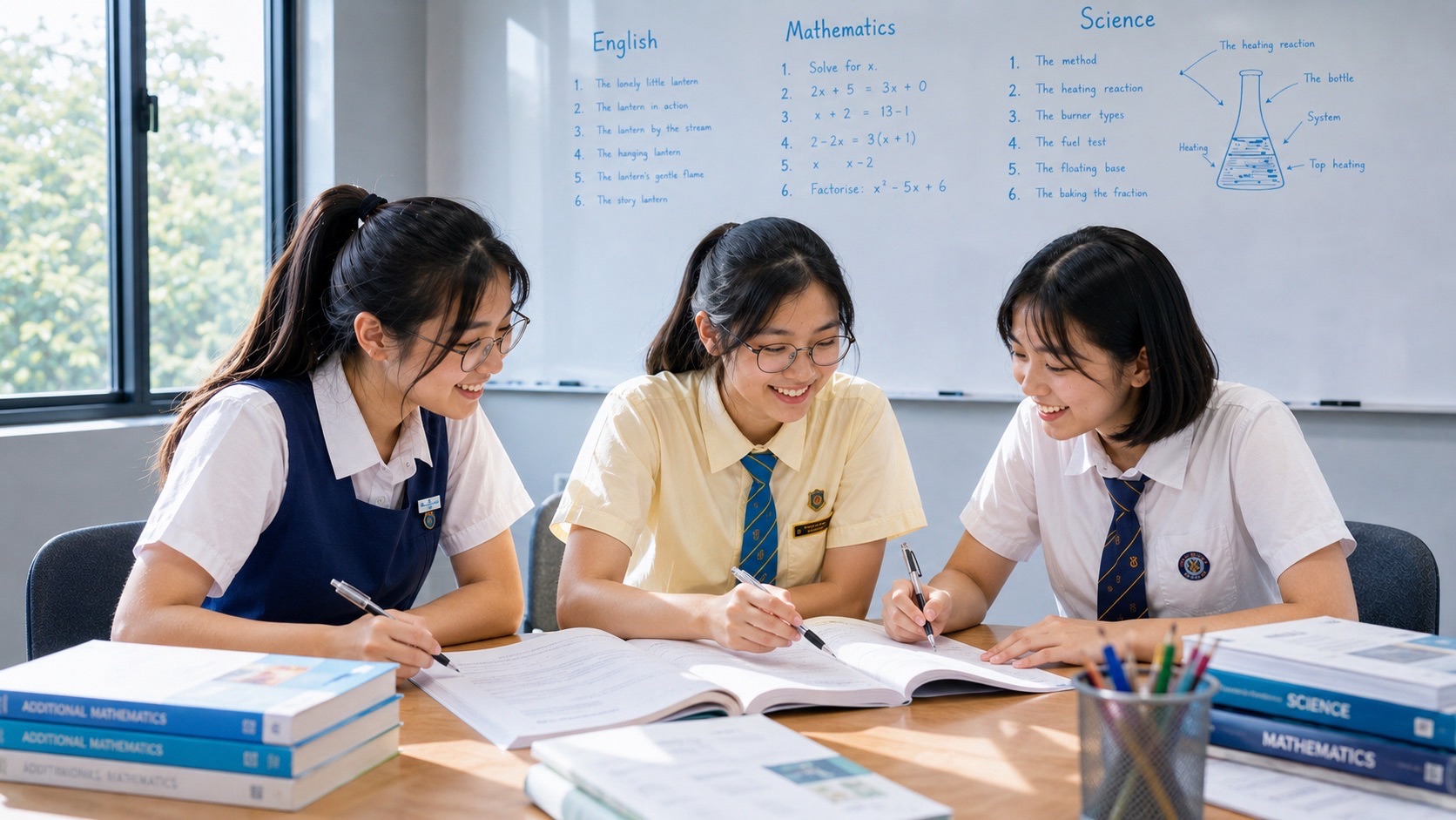
Parents preparing a student for Secondary 2 G3 Geography should focus on the relationships among housing, transport, land use, accessibility and environmental quality in cities. The student should be able to read maps, identify spatial patterns, explain why urban services are located in particular places and evaluate planning decisions using evidence. Secondary 2 is where earlier understanding of water and natural vegetation becomes useful for thinking about the sustainability of a built environment. Start by reviewing schoolwork on maps, graphs and geographical explanations. Repair recurring interpretation and writing gaps, then apply those skills to unfamiliar urban situations instead of memorising one model answer.
MOE’s Lower Secondary G2 and G3 Geography syllabus is framed around Sustainable Resource Use and Management. Its second thematic question, How Can We Sustainably Build Cities?, examines Housing and Transport Systems and integrates Geographical Investigation. Earlier topics on Water and Tropical Rainforests and Mangroves supply valuable ideas about natural-resource management. The current G3 school programme determines teaching order, fieldwork and assessments. Secondary 2 G3 Geography is not the 2027 national SEC Geography K329 paper; a pupil studying Secondary 2 in 2027 would ordinarily sit SEC in 2029 only if registered for a relevant upper-secondary subject.
Quick information for parents
• Subject: Secondary 2 G3 Geography under Full Subject-Based Banding.
• Core second-year context: sustainable cities, with Housing and Transport Systems across the prescribed lower-secondary syllabus.
• Major geographical ideas: urbanisation, density, land use, services, access, mobility, environmental impacts, management and trade-offs.
• Key skills: reading thematic maps, working with graph units, explaining spatial patterns, comparing perspectives, evaluating strategies and conducting supervised investigation.
• Useful home routine: one map/data task, one process explanation, one judgement paragraph and a weekly corrections check.
• Parents should check: actual school unit order, fieldwork methods, assessment requirements, source rules, teacher feedback and Secondary 3 subject choices.
• Important limit: the upper-secondary full Geography K329 and Humanities Geography K335 examination specifications are different subjects and should not be used as the school’s Secondary 2 timetable.
Why Secondary 2 Geography is not simply more mapwork
Students arrive with ideas about natural resources, vegetation, distribution and the environment. Secondary 2 introduces the challenge of cities: people need homes, mobility, services and opportunities, but development uses land, energy and resources and can create environmental pressures. The pupil must recognise that a city is a system of interacting activities and infrastructure rather than a set of isolated buildings on a map.
A G3 student should develop explanations that connect spatial patterns and their causes. A cluster of shops near a transport station might reflect accessibility and pedestrian flows, but a map of shops alone does not prove how many customers are present or why a particular owner selected the location. Geography distinguishes observed association from a cause requiring supporting information.
The subject also expects judgement. One transport strategy may reduce congestion under particular conditions but have costs or effects on other groups. One housing measure may provide more units while increasing demand for green space or utilities. An answer should identify who benefits, what changes and what remains uncertain. This is more demanding than saying a proposal is ‘good because it is sustainable’.
G3 as a subject level and later Humanities choices
G3 is the General 3 level of the individual Geography subject, broadly aligned historically with the former Express subject standard. Full Subject-Based Banding allows eligible students to study different subjects at different levels rather than defining the whole child by one stream. A good writer may still have difficulty with numbers and graphs; a confident map reader may need help articulating evaluation. Parents should diagnose skills rather than assume the label guarantees fluency.
The G3 lower-secondary course is not automatically identical to a later full G3 Geography national subject. At upper secondary, the school may offer full Geography or Humanities combinations depending on its programme and the student’s eligibility. SEAB’s 2027 catalogue lists full Geography K329 and Humanities (Social Studies, Geography) K335 separately. Their paper structures and scopes differ.
Secondary 2 is an appropriate time to ask for the actual Secondary 3 subject-combination briefing. Do not tell a pupil that a particular Humanities subject is guaranteed because of one result. Sustained readiness, the complete subject combination, school availability and official rules matter.
The lower-secondary G3 curriculum at a glance
| Area | What students learn | What an answer should demonstrate |
|---|---|---|
| Housing | Housing needs, locations, patterns, impacts and sustainable management | Explain a relationship between development and residents |
| Transport Systems | Nodes, routes, infrastructure, modes, accessibility and impacts | Interpret a network and evaluate mobility |
| Geographical Investigation | Question, methods, data, interpretation and reflection | Use reliable evidence and recognise limits |
| Earlier natural-resource learning | Water, tropical rainforests, mangroves, management | Connect environmental considerations to urban planning |
| Geographical thinking | Place, space, pattern, process and scale | Explain the significance of evidence in context |
The school may use case studies from Singapore and other cities. These help students compare contexts and recognise that a strategy that works in one place may not transfer unchanged to another. Parents should support the relevant case work without inventing current statistics or replacing school resources with an unrelated global ranking.
Some G3 outcomes involve deeper comparison or evaluation than G2, despite shared syllabus themes. The school explains the expected depth and marking. A longer paragraph is not inherently a stronger one: what matters is whether the causal mechanism, evidence and judgement are accurate.
Start with a map, graph and judgement diagnostic
Ask the child to complete one map-reading question, one data description and one short judgement about an urban facility. Inspect where the first error occurs. Is the map’s key misunderstood? Is the student using totals where rates are requested? Are two places compared using different criteria? Is the proposed solution presented with no mechanism or limitation?
- Map-reading: identify title, scale, legend, route and location.
- Data interpretation: state exactly what the axes, periods and units measure.
- Geographical explanation: connect a human or physical process to the distribution shown.
- Evaluation: address different stakeholders, environmental and economic considerations.
- Investigation: define what data would answer the question and whether the sample is suitable.
- Communication: answer the command word using the information supplied rather than a memorised essay.
Keep a small correction notebook with the original weak answer, the more accurate reasoning and a changed question to test it a few days later. A pupil who has learned to compare transport access should be able to do so using a different map without being told which model answer to copy.
Urbanisation and the changing demands of cities
Urbanisation can increase the concentration of people and activities in built-up areas. This creates demands for housing, transport, water, services and environmental management. A rise in population does not by itself tell us whether residents’ quality of life has improved or declined.
Give a fictional comparison of two urban areas with different populations and land sizes. Ask which has greater density and what other evidence would be needed to assess access to parks or facilities. The student should not confuse total population with population density.
The learner should define the quantity and then interpret it. A numerically correct density is only useful when the conclusion relates to the geographical question being asked.
Characteristics of housing in cities
Housing may differ in building height, density, age, land use, ownership and proximity to services. A useful geographical description identifies where types of housing are concentrated and whether they show a spatial pattern.
Use a map showing high-rise blocks near a transport route and lower-rise housing elsewhere. Describe that pattern before suggesting reasons. The map may support a relationship, but it cannot establish every resident’s income or preference.
Ask the student what further evidence could test the explanation. An interview, planning document or more detailed map might clarify an observation that the first image cannot prove.
Why housing is located where it is
Housing location depends on land availability, planning, access to employment or amenities, transport connections and other factors. Not every city has identical land-use constraints or policies, so an explanation should match the particular place.
A fictional development near a rail station might provide convenient access for commuters, but may face cost or space constraints. The student should name both the accessibility relationship and a possible planning trade-off.
The answer needs a causal link: proximity to a transport node can influence access, which may make a site attractive under the stated circumstances. Simply writing ‘because transport’ is incomplete.
Urban housing density and sustainability
High-density residential development can accommodate many homes in limited space, which is important in land-constrained cities. But high density also creates demands for shared services, mobility, utilities and environmental management.
Compare two hypothetical neighbourhoods with similar land area and different housing densities. Ask whether the denser one necessarily has lower quality of life. It does not; facilities, design and management matter.
A strong evaluation considers housing provision alongside environmental and social conditions. Avoid treating density alone as a complete assessment of sustainability.
Housing and access to amenities
Parks, shops, clinics, schools, libraries and public spaces support neighbourhood life. Their location and design influence how different residents can use them, and accessibility is not identical to simple straight-line distance.
A clinic may be close on a map but difficult for a wheelchair user if paths are inaccessible. A playground may be valuable to families while requiring maintenance and suitable safety provision. Ask which users are most directly affected.
The child’s judgement should recognise different age, mobility and household needs. One group’s convenience does not automatically represent every resident’s experience.
Singapore public housing as geographical context
Singapore offers examples of planned residential towns, different housing forms, transport connectivity and common amenities. Students should learn to examine how land use and infrastructure work together, not produce speculation about the property market.
Use a school-approved map of a residential area and identify housing clusters, public transport, schools and parks. Ask what the spatial relationships may suggest, then distinguish those suggestions from confirmed usage statistics.
Geography preparation is not property investment advice. The pupil needs to explain location, accessibility and environmental impact, not predict HDB resale prices.
Housing impacts on the physical environment
Construction and urban land use can affect vegetation cover, drainage, surfaces, noise and local environmental conditions. These effects depend on the site and the design. A photograph of a building cannot establish every environmental consequence.
Compare a paved space and a vegetated area in a school-provided example. Identify observable differences and discuss possible effects on temperature or runoff that would require measurements to quantify.
A good explanation identifies the relevant process and evidence rather than simply saying that housing causes pollution. The scale and specific development matter.
Housing impacts on people
Housing development can improve shelter and access to opportunities, while also changing neighbourhood character or creating pressures on services. People experience these effects differently depending on their needs and circumstances.
An imagined neighbourhood renewal project may help some residents by improving facilities while requiring others to adjust to temporary construction or relocation. Ask what evidence supports the claim about each group.
A balanced answer avoids broad statements that all residents are happy or unhappy. State the affected stakeholders and the specific mechanism.
Housing management strategies
Urban housing strategies may involve land-use planning, redevelopment, facility provision, environmental design and engagement with affected communities. Their effectiveness depends on the problem, implementation and resources.
If a new estate needs more public space, one strategy could integrate recreational areas within a development. Discuss how that would help and which maintenance or land-use constraints remain.
The student should evaluate both intended benefit and limitation. A proposal is not automatically effective merely because it has an environmentally friendly name.
Transport systems: networks, nodes and routes
A transport network includes links and nodes connecting places. Transport modes include rail, road, walking, cycling, air and water services depending on context. The arrangement influences how people and goods move and where activities concentrate.
Use a schematic map to identify a transport interchange, connecting routes and a residential area. Ask what the map reveals about connectivity and what it cannot establish about actual waiting times or capacity.
The student should identify the network’s scale and the relevant type of access. A route drawn as a line on a map may involve conditions not visible there.
Types of transport infrastructure
Roads, rail tracks, stations, bridges, terminals, walking paths and cycling links are different infrastructure elements. Their quality, location and integration affect service, safety and access.
A corridor with a covered walkway may improve the experience of some pedestrians, while its effectiveness also depends on where it leads and whether crossing points are safe. A picture cannot establish actual usage patterns.
Ask which infrastructure change addresses the precise problem in the question and what users or activities it affects.
Transport-node locations
Transport nodes may be concentrated near activities, employment, dense populations or major connections. A network’s structure can influence the location of other services and vice versa.
A station near a town centre can make the area accessible, while the concentration of activities may increase demand at that station. These relationships can interact rather than having a single one-way cause.
The pupil should use data, planning information or an appropriate case to justify a cause, not infer exact ridership from the number of map symbols.
Accessibility versus mobility
Mobility concerns the movement of people, while accessibility is about reaching destinations and opportunities. The shortest journey on a map may not be the easiest for all people, particularly where barriers, transfers or limited step-free access exist.
Compare a route requiring several stairs with another offering a step-free connection. Different users may reasonably prefer different routes. The student should explain whose mobility needs matter and which facilities provide access.
Avoid assuming all users are equally mobile. An inclusive geographical judgement considers different ages, disabilities and practical circumstances.
Transport demand and congestion
Transport demand varies with time, place and activity. Congestion can occur when network demand exceeds practical capacity under given conditions. The cause and consequence may differ among cities and modes.
A hypothetical data table may show longer journeys during commuting hours. The learner should describe the difference and then discuss possible factors, while recognising that the table alone may not establish every cause.
A new road is not guaranteed to eliminate congestion indefinitely. Evaluate strategies using the specified context rather than an automatic claim.
Transport and environmental pressures
Transport systems can affect air quality, noise, land use and energy consumption. The scale of these impacts depends on modes, technology, travel patterns and infrastructure, rather than every vehicle having identical effects.
A school case might compare a high-capacity public transport option with many private vehicle trips. Ask what environmental and land-use considerations are relevant and which numbers would be needed for a fair comparison.
Do not invent current emissions figures. State the mechanism and use figures only when they are supplied or verified.
Intermodal connectivity
Intermodal connectivity refers to links between different modes of transport. An interchange may connect rail, bus and walking routes, helping users reach multiple destinations with fewer barriers.
A schematic town map can show how buses feed a rail station. Ask how a passenger transfers and where access difficulties might arise. A good response considers both the physical link and the users’ experience.
An integration strategy’s success should be judged using access, capacity, reliability and the particular community’s needs, not the appearance of a modern building.
Land-use and transport planning
Housing and transport decisions influence one another. Locating homes near services can change travel demand, while a new transit route can shape development opportunities. Integrated planning aims to consider those relationships rather than build systems in isolation.
Ask the child to evaluate a proposed housing area with a nearby interchange, school and park. Which needs are met, and what pressures remain? Use the given land-use and mobility evidence.
A strong explanation connects the planning decision to a geographical outcome, with awareness of trade-offs such as space, cost or environmental change.
Transport policy and road safety
Laws, policies and road-safety design can manage behaviour or reduce risks. The correct strategy depends on the nature of the problem, and outcomes should be measured rather than assumed.
A fictional school crossing with heavy traffic may benefit from safety changes, but the particular design depends on vehicle movements and pedestrians’ needs. The student’s response should identify the hazard and the action addressing it.
Do not encourage independent roadside counting in unsafe conditions. School-supervised observations and public data can teach the same reasoning safely.
Transport technology and information
Route planners and mobility technologies can improve access to information and help manage networks, but data quality and users’ digital access still matter. A journey estimate is not a guarantee of exact travel time.
Ask the pupil to distinguish a published schedule from a real-time service alert, and to identify which source is relevant to a particular geographical question.
The learner should not confuse a digital depiction with the whole physical system. Technology is a tool for evidence and decision-making, not a substitute for evaluating it.
Geographical Investigation: housing
MOE’s Housing GI offers opportunities to examine how amenities and facilities in a neighbourhood are used and how they affect people or the environment. Students should understand how to frame a question that can be investigated at a suitable site.
An approved investigation might examine the distribution of shaded seating at a public space. The data method should describe the relevant features and perhaps user experiences, but one observation period cannot represent every day or resident.
Parents should help with safety and organisation without conducting the analysis or inventing results. The school’s actual GI requirements govern locations, permissions and assessment.
Geographical Investigation: transport
Transport GI considers mobility options, users’ needs and the impacts of a transport system on people and the environment. Possible methods can include safe observations, maps, interviews with permission and existing public datasets.
A school-led project could compare pedestrian access around two facilities. The pupil needs explicit criteria and should recognise that two sites may differ in more than one factor.
Careful sampling, privacy and safety matter. Do not send children alone to traffic-heavy roads to conduct counts or interviews.
Sampling and limits of evidence
An investigation’s data describe the times, places and people actually observed or surveyed. A volunteer sample may not represent the whole community, and data collected on a weekend may not represent a weekday.
Ask whether a survey of only classmates can establish the mobility needs of all older residents. It cannot, although it may be useful for understanding the classmates themselves.
A specific improvement addresses a known limitation, such as observing relevant periods or including appropriate user groups under school guidance.
Using secondary data responsibly
Official maps, published transport figures, research reports and other secondary sources can add information to a student inquiry. Every figure has a date, scope, unit and method, and these should be checked.
A dataset reporting total passenger trips should not be equated with the number of unique people unless that is what was measured. Percentages and totals may require different interpretations.
A good source reference makes the claim checkable and avoids outdated statistics being presented as current facts.
Geography paragraphs and evaluation
The command word determines what the answer should do. ‘Describe’ states a pattern, ‘explain’ links a mechanism to an outcome, ‘compare’ addresses both sides and ‘evaluate’ weighs evidence and constraints before judging.
If asked whether a bus interchange location is appropriate, the pupil may consider proximity to population, access, space, safety and environmental impacts. A conclusion should prioritise relevant criteria rather than declare all options equally attractive.
Use a temporary structure of point, process, evidence, limitation and conclusion where appropriate. Different marks and questions require different lengths, and the student should remain responsive to the task.
Using source photographs accurately
Photographs may document physical features and human activities in a particular place and time. They may be powerful evidence but cannot provide a full history of the site or all residents’ opinions.
A photograph showing a sheltered bus stop indicates that the structure exists, but not whether buses arrive on time or whether all nearby areas have similar shelters. Other data would be needed.
Teach the student to separate the visible observation from the inference. The same discipline supports later upper-secondary Geography and the interpretation of online images.
Comparing Singapore with other cities
The MOE syllabus includes management strategies from Singapore and other countries. Comparisons are useful when they focus on equivalent criteria and account for differences in context.
A public-housing or transit strategy may be suitable in a dense, compact city but require changes in a more dispersed settlement. The child should identify physical, social and economic conditions rather than assume a policy can be copied directly.
A fair comparison recognises that different problems may require different solutions. Avoid invented rankings and one-size-fits-all claims.
A twelve-week G3 Geography improvement plan
| Weeks | Main focus | Progress to review |
|---|---|---|
| 1–2 | Check prior resource topics and diagnose maps, graphs and writing | Two precise skill targets |
| 3–4 | Build housing patterns, density and facility relationships | Supported spatial explanations |
| 5–6 | Examine housing strategies and environmental or social consequences | Balanced explanations using data |
| 7–8 | Study transport networks, nodes and access | Accurate maps and mobility comparisons |
| 9–10 | Develop school-directed geographical investigation | Ethical, well-documented methods and conclusions |
| 11–12 | Interleave urban evidence and evaluate competing strategies | Independent judgements with appropriate limitations |
The programme is a family example, not the school calendar. Fieldwork and thematic units may occur in a different order. The pupil should follow current teacher materials and spend extra time repairing the skill that causes the greatest difficulty. Three focused study activities and a short corrections check per week can be more sustainable than several unmarked essays.
After each correction, use a changed map or scenario. If the student can interpret a new housing-density chart or explain accessibility for a different user group without prompting, the method is transferring. If not, return to the underlying concept rather than adding unnecessary complexity.
What parents should ask the Geography teacher
- Is the student confirmed for G3 Geography and which two-year topics are scheduled now?
- What are the expected levels of explanation, comparison and evaluation?
- How are maps, numerical evidence and fieldwork assessed?
- Which neighbourhood or transport GI has the school selected?
- What permissions, safety requirements and privacy rules apply?
- Which current school resources are recommended?
- What are the child’s strongest and weakest Geographical skills?
- When will the school brief pupils on Secondary 3 Humanities combinations?
How tuition may help—and when it may not
Additional help can be useful when the learner repeatedly misinterprets data, does not connect geographical conditions to an outcome or writes evaluations without evidence after classroom teaching and feedback. A tutor should examine actual work, identify the missing reasoning and use a new case to check transfer.
Small-group lessons can support comparisons and discussions when every pupil contributes. Individual teaching may help a concentrated graph or writing weakness. Neither format guarantees a future subject choice or SEC grade, and both should complement rather than replace school-led geographical investigation.
Common mistakes in Secondary 2 G3 Geography
Confusing population with density. A large total population does not automatically imply a greater number of people per unit area. Check the denominator and scale.
Calling proximity the same as access. Straight-line distance may overlook walking routes, transfers, physical barriers and different mobility needs.
Explaining a map before describing what it shows. Begin with the observed pattern and relevant locations, then introduce a supported mechanism.
Assuming every transport or housing policy is universally best. Environmental, social and economic conditions and stakeholders differ across places.
Treating one fieldwork sample as the whole city. State when and where observations were collected and recognise sampling limitations.
Using full 2027 K329 SEC papers as Secondary 2 school tests. K329 is a separate upper-secondary examination, and school G3 Geography follows its current lower-secondary teaching plan.
Frequently asked questions
Is Secondary 2 G3 Geography a national SEC paper? No. It is a lower-secondary school subject, with school-based assessment. Upper-secondary Geography and Humanities papers are different.
What are the main second-year topics? The MOE two-year syllabus includes Housing and Transport Systems under the sustainable-cities thematic question. Ask the school for the exact current sequence.
Does G3 Geography involve fieldwork? Yes, Geographical Investigation is integrated across lower-secondary topics, with school-guided inquiry, source handling and safety requirements.
Can a parent practise with local maps? Yes. Public maps and accurate official information can support observation and spatial reasoning. Avoid inventing visitor counts, property prices or traffic statistics.
Does G3 Geography guarantee full Geography in Secondary 3? No. School offerings, eligibility and subject-combination decisions determine later courses.
How can the student improve evaluation? Explain the proposal, identify relevant impacts and stakeholders, consider a real limitation and justify the decision based on evidence.
Is extra tuition always needed? No. Meaningful school lessons, focused practice and teacher consultation may be sufficient. Additional help is best selected for persistent diagnosed weaknesses.
A first-term checklist
- Confirm G3 Geography and current Housing/Transport teaching topics.
- Review water and vegetation as earlier sustainability foundations.
- Use the map legend, scale and spatial pattern before drawing conclusions.
- Distinguish urban population, area and density.
- Explain relationships among housing, services and environmental conditions.
- Compare transport routes, modes, accessibility and user needs.
- Consider social, environmental and economic impacts fairly.
- Use school-approved inquiry methods and document the source of data.
- Avoid risky transport observations or intrusive surveys.
- Retest corrections using unfamiliar graphs or maps.
- Ask about later Humanities combinations and school criteria.
- Protect a realistic balance of studying and rest.
Three useful parent-led urban Geography activities
The first activity is a map comparison. Give the pupil two maps of the same hypothetical neighbourhood at different scales. One might show homes, bus stops and the town centre; the other might show a detailed pedestrian route. Ask which questions each map can answer and where information is missing. A broad map can show network connections, but it may not reveal kerb ramps or shelter along a particular path. The student should identify both the strength and limitation of each representation.
The second activity is an accessibility comparison. Provide two fictional routes with a stated distance, number of crossings and access conditions. Ask the child which route is preferable for a pupil, an older adult and a wheelchair user. The answer should depend on the specified needs and criteria, not a blanket assumption that the shortest distance is always the best choice. Have the student write a brief recommendation and one limitation of the available data.
The third activity is a decision about land use. A fictional empty lot could become housing, a small park or a community facility. Ask what environmental, social and economic factors matter and which additional information is needed. The student should identify a plausible benefit and constraint for each option before recommending one. This practises geographical evaluation without pretending to have made a real planning decision from insufficient data.
These exercises should use invented data or suitable school and official information. Parents should not gather personal information about strangers, send children onto busy roads to count traffic without supervision or claim current local conditions based on an illustrative scenario. The aim is independent geographical thinking: select evidence, interpret it carefully and qualify conclusions.
A compact geographical investigation quality check
- Does the inquiry question identify a particular place, process or user group?
- Does the chosen map, survey or observation actually address that question?
- Are time, unit, sample and source recorded accurately?
- Are conclusions limited to the evidence collected?
- Does each improvement address a specific weakness in the method?
Official sources and companion guides
Use MOE’s Lower Secondary G2 and G3 Geography syllabus and MOE Secondary Education. SEAB’s 2027 G3 subject list is a later graduating reference and should not be mistaken for Secondary 2 assessment. The related Secondary 1 G3 Geography and Secondary 3 G3 Geography guides cover different learning stages.
Secondary 2 G3 Geography preparation succeeds when a child can look at an unfamiliar map, identify a genuine pattern, explain the relationship behind it and make a balanced decision using evidence. Those skills support future Geography and Humanities and help the student understand the planning choices shaping everyday urban life.
Explore related parent guides: Secondary 1–4 preparation and transition guides.